Norway's Romsdal valley attracts hikers from all around the world with some challenging trails to rewarding viewpoints. Here's what you need to know.
Hiking in Norway is a spectacular experience regardless of where you choose to base yourself, but some regions simply take things up a notch.
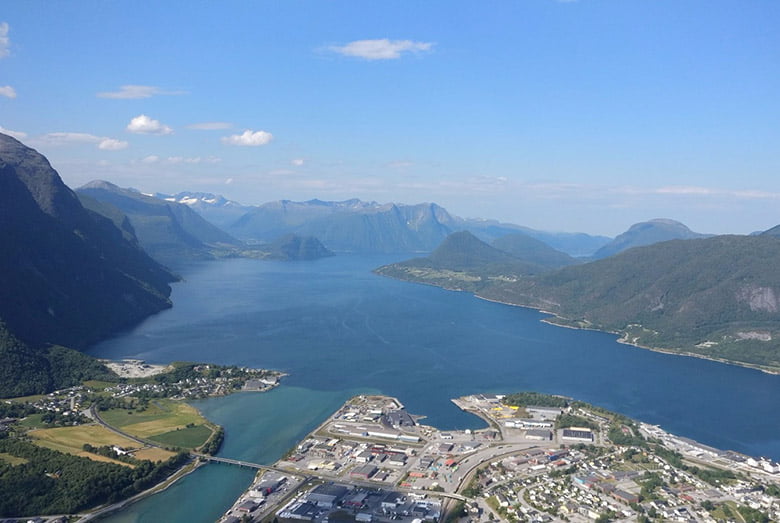
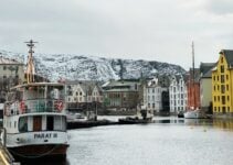
One of those is Åndalsnes and the Romsdal valley, located at the north of Norway's vast fjord region. If you're struggling to place it on a map, take a look:
To reach Åndalsnes, the biggest town in the valley, by car takes around six hours from Oslo, 8-9hrs from Bergen, and up to 5 hours from Trondheim.
The town is also connected to the national rail network thanks to the 114km (71 mile) long Rauma Line, which connects to the Oslo to Trondheim railway at Dombås.
Åndalsnes and the Romsdal Valley
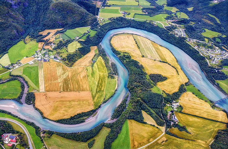
The 60km (37 mile) long Romsdal valley is Norway in miniature, with everything from winding rivers and gushing waterfalls to ragged mountain peaks and lush green forest within a relatively small area.
Most travellers choose Åndalsnes as their base to explore the area, not least because it's the closest town to the world-famous Trollstigen mountain pass.
Close to Åndalsnes, the Trolltindene range incorporating the Trollveggen mountain wall are probably the valley's best-known mountains from a visual perspective.
The spiky peaks of Trollveggen have long been a popular destination for BASE jumpers over the years, as they make up the tallest vertical rock face in Europe.
It hit the headlines recently due to the risk posed by the mountain Mannen of collapsing and blocking the river, potentially causing a severe flood. The story inspired the one-word webpage Har Mannen Falt Ned? (Has Mannen Fallen Yet?)
Anyway, enough of the introduction! Let's get into some tips for hiking in and around Åndalsnes.
Hiking Romsdalseggen
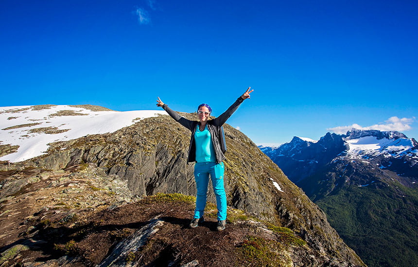
Without doubt the most popular and well-known hike in the region is the Romsdalseggen ridge, one of the most famous walks in all of Norway.
On clear days, you can see all the way to the ocean, plus you get a unique perspective of the Romsdal mountains that few other tourists get to see.
But be warned, this one isn't for beginners, or those who don't deal well with heights.
It's also not a hike to consider if you're the kind of person who doesn't like to plan, because the ridge is a challenging all-day commitment, albeit one with a substantial reward.
The 10-kilometer (6.2-mile) hiking route is accessible from July to September and begins with a 9:30am bus transfer from Åndalsnes to the hike’s starting point at Vengedalen.
From the trailhead, you can expect the hike to take 7-8 hours at normal speed. Although the challenging hike doesn’t require any professional equipment, sturdy hiking boots and wind- and waterproof clothing (regardless of what you think the weather is going to be like!) are absolutely essential items.
The 150kr bus fare includes an information leaflet and map. Be sure to take enough provisions to last the day including plenty of water, because once you're there, hiking the ridge to Åndalsnes is the only way back. Consider your plans carefully if the weather forecast is poor and/or you are an inexperienced hiker.
The Rampestrekken viewpoint
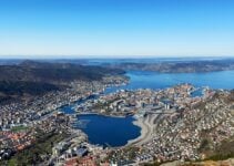
Not everyone wants to or is capable of tackling the full Romsdalseggen ridge. For those short on time there is a great alternative from Åndalsnes, offering views like this:
The hike to Rampestreken viewpoint is actually the final stretch of the Romsdalseggen trail, just starting from the opposite end. Although the return walk takes around two hours compared to an entire day for the full trail, this one still needs a decent level of physical fitness.
That's because although the distance of the return walk is less than three kilometres, the difference in elevation from the start to end is 520 metres.
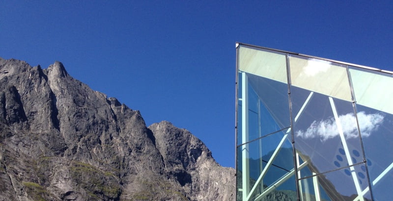
Once you get to the viewpoint, it's up to you whether you want to step out onto this purpose-built viewing platform for the full Rampestreken experience:
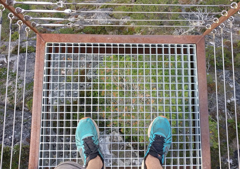
From the trailhead that is about a five-minute walk from Åndalsnes railway station, you can expect a mix of forest trail, metal staircases, and stone steps built by sherpas.
The Rauma river walk
Climbing up a mountain not your thing? How about a much gentler ramble along a river?
Paths run alongside or close to the river for some of its 68km (42 mile) route through the valley. Although largely flat, you should be prepared for some slippy and/or rocky terrain.
Many creeks and waterfalls merge into the Rauma as it winds along the valley floor, and there are many sights to see along the route. The 60-metre-high stone Kylling bridge standing above the powerful Slettafossen rapids is a highlight, and a great place to stop to break up a road trip.


Most marvelous David. I thank you for your inside knowledge and obvious love of this amazing country. I am planning a return journey to my ancestral homeland as soon as I can . Please continue, I am curious as to how you have broken the code to Norway. I work to do the same. Residence I suppose, I found so many wonderful folks when I visited. You obviously have become a native. As well as an intriguing and engaging travel correspondent Joel Hidahl
Thank you so much for the kind words!
Beautiful land, beautiful picture, beautiful article. Norway’s beauty really tops of 3times special every day. Interesting article read.
Do enjoy the articles. Great insight and encouragement. Waiting for lockdown to lift for me to go.