Gaularfjellet is one of the lesser-known 18 Norwegian scenic routes. Here's what you need to know about the road trip.
On a summer road trip last year, one of the things we had wanted to do was chalk off a few more of Norway's scenic routes. The road trips are a natural bucket list for drivers especially during the summer.
After driving a couple of the best-known ones, we left Balestrand to head north. Moments later, we spotted the brown sign signifying the start of a scenic route. It was one I hadn't even realised was here!
It turned out to be Gaularfjellet, a historic route over the mountains between the Sogn and Sunnfjord districts. Split into several sections, it totals 114km in length with a total elevation gain of 784 metres.
Watch highlights of the drive
If you prefer to watch rather than read, check out this video we made along the way.
Now if that has piqued your curiosity, read on for the details.
Introducing the Norwegian scenic routes
Norway's national scenic routes are 18 designated roads that take you through the best scenery Norway has to offer.
Government funding has improved conditions and facilities along each route. Rest stops, viewpoints and picnic areas are now combined with modern architectural features to make them tourist attractions in themselves.
Introducing Gaularfjellet
Connecting the epic Sognefjord with the Sunnfjord region, Gaularfjellet is a historic mountain crossing. Today it's a peaceful alternative to the main roads and a popular tourist route.
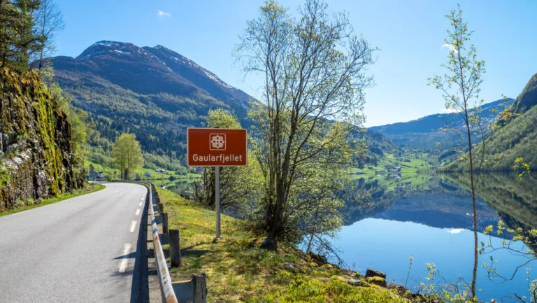
The designated scenic route includes the part of route 613 between Moskog and Balestrand and route 610 between Sande and Eldalsosen.
Between Mel and Mjell, the road is closed during the winter. This closure typically takes place from December to the end of April, but parts of the road can be closed at short notice during bad weather or at night for the first few weeks after the spring opening.
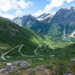
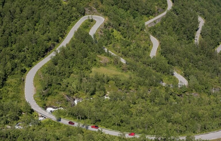
The route is best known for its serpentine mountain climb, spectacular viewpoint and numerous waterfalls along the watercourse.
Balestrand
The charming village of Balestrand lies on the shore of the Sognefjord at the southern end of the route.

This is a popular stop on a fjord Norway trip with highlights including the local cider farm, the attractive Kviknes Hotel and intriguing English church. I would highly recommend an overnight stop here as part of a longe road trip.
The route starts just a few miles north of the village, where there is also a ferry crossing from the southern side of the Sognefjord.
Upon leaving Balestrand, the beauty starts immediately. The road (route 13) skirts the fjord as it heads towards the mountains giving a sensational view. It almost looks like a painting.
So much so, we had to stop the car for a photo just five minutes into the journey! Once back in the car, the scenery quickly changes and within 15 minutes, you're making your way up the serpentine mountain road.
Utsikten
Since it opened in 2016, this spectacular viewpoint has quickly become a tourist attraction in itself.
The triangular concrete platform has three ‘wings' that give visitors different perspectives on the mountain valley and hairpin turns below, while the bathroom block (summer opening only) provides an obvious benefit to drivers.
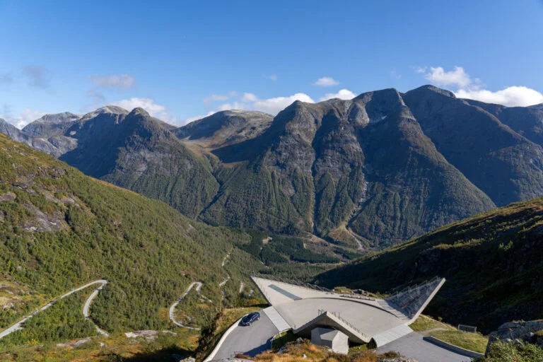
Elevated more than 700 meters above sea level, the platforms use concrete that will acquire natural vegetation and eventually blend into the mountain colours.
When we arrived at Utsikten, the valley and surrounding peaks were shrouded in cloud. But it took just 10 minutes for much of the cloud to clear, giving us the fantastic view we were hoping for.
“I believe the special architecture and its location in the landscape is what draws people here, in addition to the fact that the view is spectacular. The architectural expression is special and the facility’s placement in nature is adapted to the location,” said Trine Kanter Zerwekh of the Norwegian Public Roads Administration.

The roads administration describes the rest of the route as the “realm of falling water.” While somewhat poetic, it's still an apt description of what you'll experience on the rest of the route.
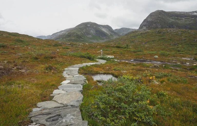
Fossestien: a trail of waterfalls
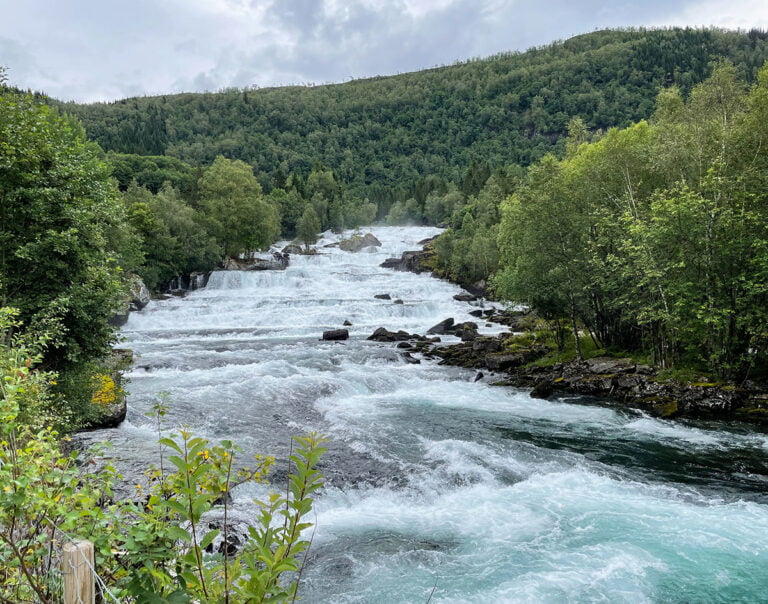
The road follows Gaularvassdraget, a protected watercourse featuring wild rapids and waterfalls but also calmer stretches.
A 21km-long hiking path Fossestien follows old trails and mountain routes along the river, past 14 waterfalls and seven lakes. Parking spots at Eldal, Likholefossen, Longestølen and Torsnesstølen are available to budding hikers.
Torsnesstølen
The water theme of Gaularfjellet is emphasised in a thought-provoking artwork at the Torsnesstølen rest stop.
Marianne Heier's artwork consists of ten wells. Nine of them are located in water-starved Malawi while the tenth is here. According to official sources, “the water represents both a specific element and a metaphor for the distribution of world resources.”
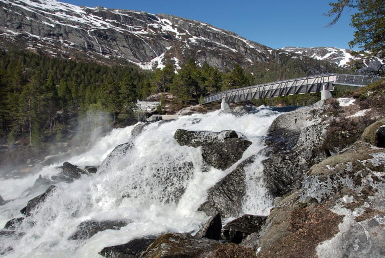
Likholefossen
Gaula's river system can be powerful and there's no better place to experience that energy than Likholefossen.
The flexible steel bridge brings visitors up close and personal with one of the most famous waterfalls along the route. It also connects with the Fossestien trail.
A few miles west of Likholefossen, the scenic route splits into two at Vik. We turned right to continue on route 13 towards the Nordfjord. Along the way, we found another natural rest stop at Viksdalen Camping.
The left turn onto route 610 continues to follow the river and is also part of the designated scenic route. Both roads end up connecting with the E39.
Hestad
Hestad is the most popular rest stop along the route 610 stretch of the scenic route. From the modern service building (with bathrooms!), two walkways begin.
One takes visitors out above the water on an elevated ramp, while the other runs along the water's edge.
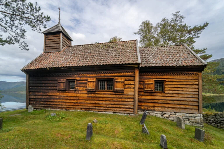
Hestad chapel is a few hundred metres from the rest stop. While it's not a Norwegian stave church, one did once stand here. It was replaced by the chapel in 1805. Original timber from the old church was used in the construction.
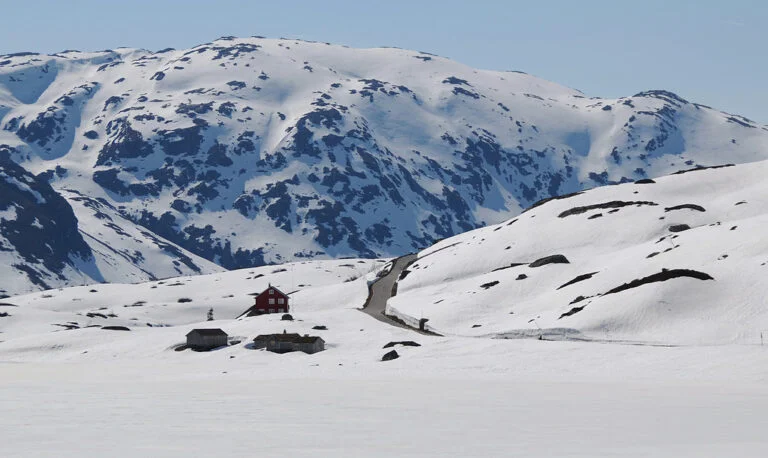
Driving Gaularfjellet in the winter
The section from Mel to Mjell is closed during the winter. This is the section from Balestrand that includes the hairpin turns up the mountain and the Utsikten viewpoint.
Closure depends on the weather and snow cover but typically takes place from mid-December to the end of April. Once open during the spring, the road can sometimes be closed at short notice due to weather, especially at night. But it is a wonderful time to visit.
Also bear in mind that the restrooms are closed from the end of October to the beginning of May.
Have you driven Gaularfjellet? Let us know what you thought. If you enjoyed this post, why not share it on Pinterest? You can find the perfect pin by hitting that red Pinterest button.

Loved this post, that video brought so many memories of when I drove that route years ago. Unfortunately since the dreaded DFDS scrapped the Newcastle Bergen route It has been too difficult to contemplate driving to Norway again! Perhaps the rumours of it being re-opened will happen!
Wonderful post! I would love a little Google map that shows the route more clearly.