
The largest glacier in mainland Europe is retreating fast. Here’s how to experience one of Norway’s greatest natural wonders safely and responsibly.
In many ways, Jostedalsbreen is the very heart of Norway.
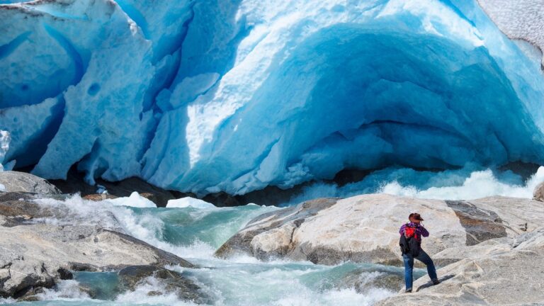
This vast ice cap sits high in the mountains of western Norway, between the inner reaches of the Sognefjord and the Nordfjord. It is the largest glacier on the European mainland, and one of the most dramatic reminders of how ice has shaped the Norwegian landscape.
At first, Norway's glaciers can seem remote, inaccessible, and best left to serious mountaineers. But Jostedalsbreen is different.
More than 20 glacier arms flow down from the main ice cap into surrounding valleys. Some can be seen from roadsides. Others can be reached by relatively short hikes. A few can even be explored on guided glacier walks, with crampons, ropes, and expert help.
That accessibility is part of the appeal. It is also part of the challenge. Jostedalsbreen is changing quickly. Like glaciers across Norway, it is under pressure from a warming climate.
Some glacier arms that once reached deep into the valleys have retreated dramatically within living memory. Others still offer that unforgettable view of blue ice, rock, water, and mountain.
So, should you rush to see it “before it disappears”? Not quite. Jostedalsbreen is not about to vanish tomorrow. But the glacier visitors see today is not the one people saw a generation ago, and it will not be the one future generations inherit.
Jostedalsbreen In Numbers
It is hard to grasp the scale of Jostedalsbreen when you are standing in front of just one glacier arm. So, here is a little perspective.
- Area: about 458 square kilometres
- Length: about 60 kilometres
- Altitude: from around 60 metres above sea level at the foot of Supphellebreen to 1,957 metres at Høgste Breakulen
- Maximum thickness: about 630 metres
- Glacier volume: about 70.6 cubic kilometres
- Largest measured annual snowfall: 12 metres
- National park area: about 1,315 square kilometres
Older guidebooks and tourism material often cite Jostedalsbreen at 487 square kilometres. The lower figure reflects more recent mapping and, in itself, tells part of the story.
Even so, the numbers are extraordinary. The glacier still contains enough fresh water to be almost impossible to imagine. But Jostedalsbreen is no longer a fixed white mass on the map. It is a living, moving, shrinking landscape.
How Jostedalsbreen Was Formed
It is tempting to think of Jostedalsbreen as a leftover from the last Ice Age, but the story is more complicated.
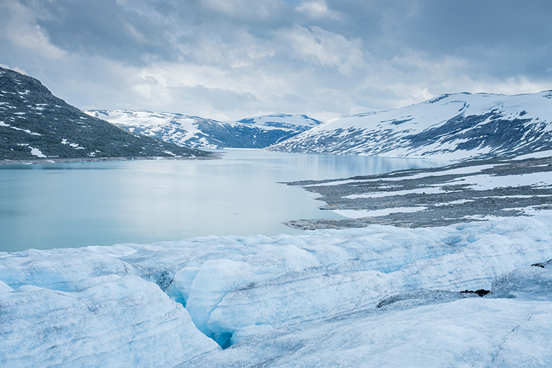
The last Ice Age ended around 11,700 years ago. During a warmer period several thousand years later, the glaciers in Norway, including Jostedalsbreen, melted away completely. They later reformed when the climate cooled and enough winter snow survived the summers to build up into ice.
Glaciers helped carve the fjords, valleys, and mountain landscapes that make western Norway so famous today. They grind down rock, shape valleys, feed rivers, and leave behind moraines and other signs of their former reach.
Jostedalsbreen reached one of its most recent high points during the Little Ice Age, a cooler period from roughly the 1300s to the mid-1800s. Around the middle of the 18th century, several glacier arms were far larger than they are today.
Nigardsbreen, for example, advanced far enough to destroy the old Nigard farm. That name lives on in the glacier itself.
The Glacier Is Changing Fast
For a long time, Jostedalsbreen was a slightly awkward example in the climate conversation. Some of its glacier arms advanced in the late 20th century, helped by heavy snowfall.
Briksdalsbreen, in particular, grew during the 1990s and became internationally known as a glacier that seemed to be bucking the wider European trend.
That period is over. Recent research suggests Jostedalsbreen could lose a substantial share of its current ice volume this century, depending on future greenhouse gas emissions.
Some projections suggest the ice cap could lose between 12% and 74% of its present-day volume by 2100. Under several scenarios, the ice cap may eventually split into three separate parts.
That does not mean every glacier arm is changing at the same rate. Jostedalsbreen is a complex ice cap, with many outlets at different elevations and aspects. Snowfall also matters. This part of western Norway is wet, and heavy winter precipitation can temporarily slow or complicate the story of retreat.
But the overall direction is clear. Jostedalsbreen remains magnificent, but it is no longer the same glacier shown in old postcards, paintings, or even travel photos from the early 2000s.
Jostedalsbreen National Park
Jostedalsbreen National Park was established in 1991 to protect the glacier and the surrounding landscape. It covers a much wider area than the ice itself, stretching across glaciers, mountains, valleys, rivers, waterfalls, and cultural landscapes.
That variety is one of the surprises of a visit. Yes, there is ice. Plenty of it.
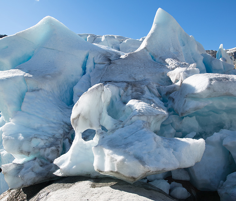
But there are also lush valleys, roaring rivers, green farms, birch woodland, high mountain plateaus, and waterfalls fed by meltwater. In places, you can move from spring-like greenery to bare rock and blue ice in the space of a short walk.
The national park has three authorised visitor centres: Breheimsenteret in Jostedalen, the Norwegian Glacier Museum in Fjærland, and Jostedalsbreen National Park Centre at Oppstryn.
Each has a different focus and works well as a starting point depending on which side of the glacier you are visiting.
Breheimsenteret is best for Nigardsbreen. Fjærland is ideal for the Norwegian Glacier Museum, Bøyabreen, Supphellebreen, and Flatbreen. Oppstryn works well for visitors staying in Stryn, Loen, Olden, or Nordfjord.
The Glacier Arms Of Jostedalsbreen
You will almost certainly not see “Jostedalsbreen” as one vast ice cap unless you are on a long ski traverse, a serious mountain trip, or perhaps looking down from the air.
Most visitors experience one of its glacier arms. These are the outlets where ice flows down from the main plateau into surrounding valleys.
Some are easy sightseeing stops. Some require a hike. Some should only be approached with a guide. Here are the best-known options.
Nigardsbreen
Nigardsbreen is one of Norway’s most accessible glaciers and one of the best places to experience blue ice up close.
It is located in Jostedalen, north of Gaupne and within reach of Sogndal. The best starting point is Breheimsenteret, the visitor centre for Jostedalsbreen and Breheimen national parks. From here, you get an impressive view towards the glacier before continuing along the valley to the Nigardsbreen parking area.
From the car park, visitors can walk towards the glacier lake. In the summer season, a small boat usually carries passengers across Nigardsbrevatnet, reducing the walking distance and adding another memorable element to the visit.
Nigardsbreen is also one of the main places for guided glacier hikes. Local guides offer a range of trips, from family-friendly walks to longer blue-ice experiences. Some tours are suitable for children from around eight years old, depending on the operator and conditions.
This is the important point: do not simply walk onto the glacier by yourself. Crevasses, unstable ice, falling blocks, and slippery surfaces make glaciers dangerous even when they appear calm. If you want to step on the ice, book a guided tour and use the provided safety equipment.
Briksdalsbreen
Briksdalsbreen is perhaps the most famous glacier arm of Jostedalsbreen, especially for cruise visitors calling at Olden.
The setting is spectacular. The glacier drops from the high ice cap into Briksdalen, a lush valley of waterfalls, steep mountainsides, and glacial water. The classic trip is the walk from Briksdalsbre Mountain Lodge to the glacier viewpoint.
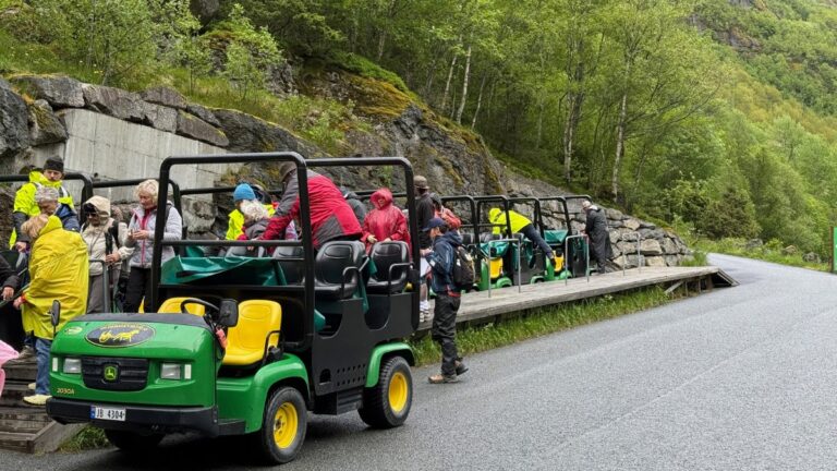
The walk is around three kilometres each way on a well-used route. It is not technically difficult, but there are uphill sections and it can be busy in summer, especially when cruise ships are in Olden.
For those who prefer not to walk the full distance, the well-known “troll cars” run from Briksdal during the season. These small vehicles take visitors up much of the route, leaving a shorter walk to the viewpoint near the glacier lake.
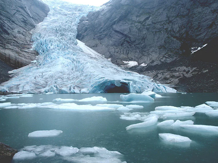
Briksdalsbreen is also one of the clearest examples of glacier retreat in Norway. Older photos show the ice reaching much farther down towards the lake.
Today, the glacier has pulled back significantly, and guided glacier hikes no longer take place on Briksdalsbreen itself because of ice conditions. Some operators now use Tystigbreen on Strynefjellet for glacier hiking instead.
That does not make Briksdal any less worth visiting. In some ways, it makes the experience more powerful. It is not just a beautiful valley. It is a landscape visibly in transition.
Bøyabreen and Supphellebreen
For visitors to Fjærland, Bøyabreen is one of the easiest glacier experiences in Norway.
This glacier arm can be seen from the road, with a short access road leading to a viewpoint near a small lake. It is a popular stop for road trippers, coach tours, and visitors to the Norwegian Glacier Museum. The view is dramatic without requiring a major hike.
Nearby Supphellebreen is also worth knowing about. Its lower section reaches unusually low, down to around 60 metres above sea level, although visitors should pay careful attention to local warnings and never approach unsafe ice or unstable areas.
Together, Bøyabreen and Supphellebreen make Fjærland one of the best bases for people who want to understand Jostedalsbreen without necessarily joining a glacier hike.
Tunsbergdalsbreen
Tunsbergdalsbreen is often described as the longest glacier arm of Jostedalsbreen. It is much less visited than Nigardsbreen and Briksdalsbreen, which is part of its appeal.
This is not a casual sightseeing stop in the same way as Bøyabreen or Briksdal. It is better suited to experienced hikers or those joining guided tours. The landscape is wilder, quieter, and gives a stronger sense of the scale of the ice cap beyond the famous viewpoints.
Tunsbergdalsbreen also has a place in glacier research history. In 1959, it was the focus of a large British-led expedition that studied glacier movement and related conditions.
Fjærland: Where Glacier Meets Fjord
Fjærland may be one of the most quietly spectacular villages in Norway. It sits at the end of the Fjærlandsfjord, surrounded by mountains, water, farms, and glacier arms. For many visitors, it is the most atmospheric gateway to Jostedalsbreen.
The village is best known for two things: glaciers and books. Several second-hand bookshops have given old buildings a new purpose, and Fjærland has become known as Norway’s book town. It is a lovely contrast: ice, fjord, and shelves of old books in a village of just a few hundred people.
For a long time, Fjærland was accessible only by boat. A road connection to Skei opened in 1986, followed by the road connection towards Sogndal in the 1990s. Even today, the village retains a slightly tucked-away feeling.
The Norwegian Glacier Museum is the obvious first stop. It explains how glaciers form, how they shape landscapes, and how climate change is affecting them. The museum is especially good for families, or for anyone who wants context before heading out to see the ice.
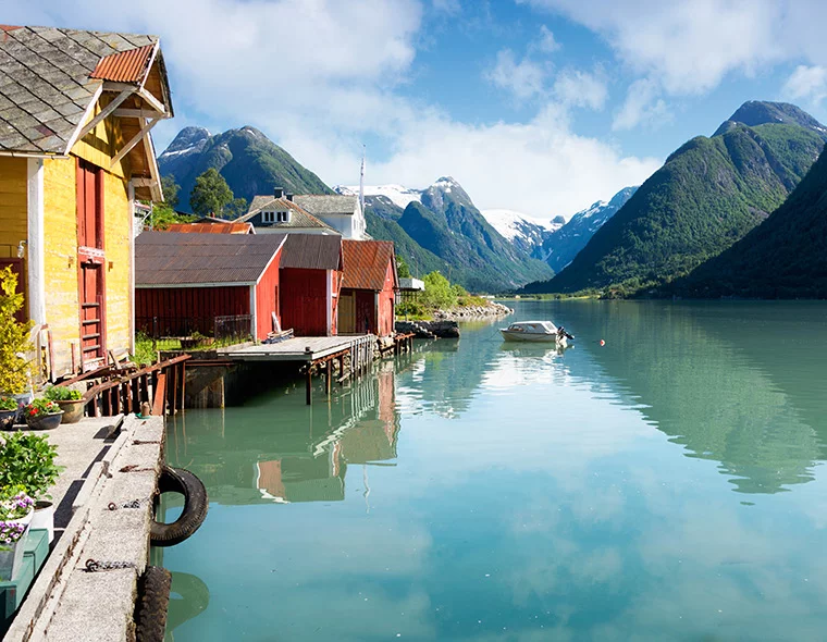
There are many hikes around Fjærland, from gentle walks to more demanding mountain routes. The hike to Flatbrehytta, a cabin around 1,000 metres above sea level, is one of the classics. From there, hikers get a dramatic view towards Flatbreen in one direction and Fjærland and the fjord in the other.
Skiing Across Jostedalsbreen
Jostedalsbreen is not just a summer destination.
For experienced ski tourers, the great classic is Josten på langs, a multi-day traverse of the ice cap. The route usually takes three days and crosses Jostedalsbreen from north to south, although exact routes depend on conditions.
This is one of Norway’s great ski adventures, but it is not a casual trip. The weather can change quickly, navigation can be demanding, and glacier travel requires knowledge of crevasse rescue and winter mountain safety.
Visitors without the necessary experience should join a guided trip. Even confident downhill skiers should not underestimate the difference between a ski resort and a remote glacier plateau.
Life Near The Glacier
There are villages and farms in the valleys and fjords around Jostedalsbreen, and life here has always been shaped by the ice.
Tourism is now a major part of the local economy. Campsites, hotels, cafés, visitor centres, guiding companies, boat services, and shuttle operators all help visitors experience the glacier landscape.
But tourism is not the whole story.
Agriculture remains important, especially in the fertile valley floors and river deltas shaped by glacial meltwater. The season can be short, and snow may cover the meadows for much of the year, but farming has deep roots here.
Hydropower is another part of the story. Glacial meltwater provides a strong summer flow into rivers and lakes, and several power plants in the wider region use this water to generate electricity.
The glacier is therefore not just scenery. It influences livelihoods, transport, farming, energy, tourism, and identity.
Getting To Jostedalsbreen National Park
A car is the easiest way to explore Jostedalsbreen National Park.
The challenge is not reaching one viewpoint. It is that the glacier has many arms and access points spread across a large area. Nigardsbreen, Briksdalsbreen, Fjærland, Oppstryn, and other gateways are not all clustered together.
For Nigardsbreen, Sogndal and Gaupne are useful starting points. In the summer season, a glacier bus usually runs between Sogndal, Breheimsenteret, and the Nigardsbreen area, making it one of the easier glacier trips to do without a car.
For Briksdalsbreen, Olden is the main gateway. This is a popular cruise excursion, but it can also be reached by road as part of a Nordfjord itinerary.
For Fjærland, a car makes things simple, but seasonal fjord trips and bus connections can also work, depending on the time of year. Fjærland combines especially well with Sogndal, Balestrand, or a wider Sognefjord road trip.
The key is to choose your glacier arm first, then plan your transport around it. “Visiting Jostedalsbreen” can mean many different things.
Staying Safe On Jostedalsbreen
Glaciers are beautiful, but they are not playgrounds. In the social media age, it can be tempting to edge closer for a photo, walk beyond warning signs, or follow tracks made by someone else.
Do not do it. Glacier fronts are unstable. Ice can collapse without warning. Rocks can fall. Meltwater rivers can be powerful and icy cold. Snow bridges can hide deep crevasses.
If you want to walk on the ice, join a guided glacier hike. Guides provide essential equipment such as crampons, helmets, ropes, and harnesses, and they understand the local conditions.
Even if you are only hiking to a viewpoint, come prepared. Weather changes quickly in the mountains. Good shoes are essential, and warm layers are sensible even in summer.
You should also bring sunglasses and sun protection. This surprises some visitors, but the glare from snow and ice can be intense on a clear day. Water and snacks are also a good idea, especially if you are hiking independently.
Finally, respect barriers, signs, and local advice. They are not there to spoil the view. They are there because this landscape moves, breaks, melts, floods, and falls.