
Home to Scandinavia’s highest mountain, Jotunheimen National Park offers visitors a dramatic introduction to wild Norway: high peaks, glaciers, deep valleys, mountain lakes, and some of the country’s most famous hikes.
Incredible views, challenging trails, mountain lodges, wild camping opportunities and one of Norway’s greatest scenic drives all combine to make Jotunheimen one of the best places to experience the Norwegian mountains.
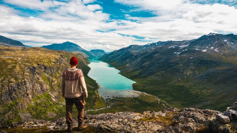
But this is not a casual stroll-in-the-park kind of place. Jotunheimen is beautiful, accessible and popular, but it is also a high mountain environment where the weather can change quickly and even famous routes demand respect.
Table of Contents
“Home of the Giants”
Jotunheimen means “the home of the giants,” and it is easy to see why the name stuck. This is one of Norway’s great mountain regions, a landscape of sharp ridges, broad valleys, icy lakes and more than 200 peaks above 2,000 metres.
The national park was established in 1980 and covers approximately 1,151 square kilometres in central southern Norway. It stretches across parts of Innlandet and Vestland counties, in the municipalities of Lom, Vågå, Vang, Årdal and Luster.
For visitors, the main appeal is the variety. You can come here for a single famous hike, a multi-day cabin-to-cabin adventure, a scenic drive, a guided glacier crossing, or simply to enjoy mountain air and big views from a comfortable lodge.
Jotunheimen is also an important habitat for wildlife. Reindeer have long been associated with these mountains, while moose, red deer, roe deer, wolverines, lynx and smaller predators such as foxes and mink are also found in and around the protected area.
You are unlikely to see most of them, but signs of animal life are part of the mountain experience.
Hiking in Jotunheimen
Hiking is the main reason most international visitors come to Jotunheimen. The best season is usually July and August, when trails are clearer of snow and the mountain lodges are in full swing. Late June and September can also be wonderful, but conditions are less predictable.
Even in summer, this is not a place to underestimate. Low cloud, strong wind, cold rain and even snow can occur in the high mountains. Good boots, warm layers, waterproof clothing, food, water, a map and a realistic plan are essential.
Many visitors focus on two famous hikes: Galdhøpiggen and Besseggen. Both are outstanding experiences, but neither should be treated as a casual tourist attraction.
Galdhøpiggen: Norway’s Highest Mountain
At 2,469 metres above sea level, Galdhøpiggen is the highest mountain in Norway, Scandinavia and Northern Europe. For many Norwegians and visitors alike, standing on its summit is a bucket-list experience.
The most popular route begins at Juvasshytta mountain lodge, reached by road from the Lom area. Because the route crosses the Styggebreen glacier, walkers must join a guided rope team. In the summer season, guided trips usually run daily, but booking ahead is strongly recommended.
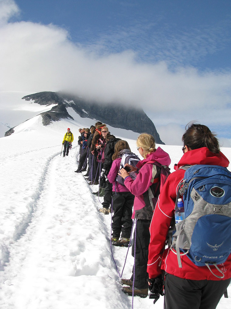
The guided trip from Juvasshytta is not technically difficult in mountaineering terms, but it is still a proper high mountain hike. The route involves roughly 650 metres of elevation gain and normally takes five to seven hours for the round trip.
Participants are provided with glacier safety equipment, but you need suitable hiking clothing, sturdy footwear, sunglasses, sunscreen, food and water.
There is also a glacier-free route from Spiterstulen mountain lodge. This route does not require a guide in normal summer conditions, but it is longer and involves a much greater climb. For fit and experienced hikers, it can be a rewarding alternative. For beginners, it is not the easy option.
Besseggen Ridge
If Galdhøpiggen is the summit everyone wants to stand on, Besseggen is the view everyone wants to photograph.
The Besseggen ridge separates two very different lakes: the emerald green Gjende far below on one side, and the deeper blue Bessvatnet on the other. The colour contrast, combined with the narrow ridge and sweeping mountain backdrop, makes this one of Norway’s most iconic hiking scenes.
Most people hike Besseggen by taking the boat along Gjende to Memurubu and walking back over the ridge to Gjendesheim.
This avoids the stress of needing to catch a return boat at the end of the hike. The route is around 13 kilometres, but the distance alone does not tell the full story.
It is a demanding all-day hike with significant elevation gain, steep sections and some scrambling.
Allow seven to nine hours, including breaks. In good weather, Besseggen is a spectacular day out. In poor weather, it can be disorientating and unpleasant. If cloud, strong wind or heavy rain is forecast, choose a lower-level walk instead.
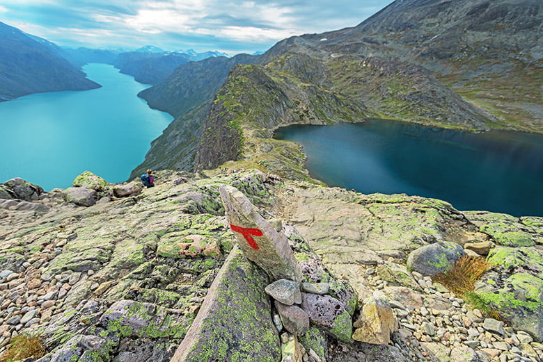
Despite the challenge, Besseggen is hugely popular. That popularity brings good infrastructure, but it also means boat tickets and accommodation can sell out in peak season. Plan ahead, especially in July and August.
Beyond the Famous Hikes
Galdhøpiggen and Besseggen get most of the attention, but Jotunheimen is far more than two headline hikes.
The region has a strong tradition of cabin-to-cabin hiking, with serviced and self-service mountain cabins forming a network across the area. Staying in a DNT cabin is one of the best ways to experience Norwegian friluftsliv, especially if you want to hike for several days without carrying camping gear.
Areas around Gjende, Leirvassbu, Glitterheim, Fondsbu, Spiterstulen and Sognefjellshytta all offer access to marked trails. Some routes are demanding high mountain crossings, while others are gentler walks suitable for families or visitors with limited time.
On the western side, Utladalen Protected Landscape is closely connected with Jotunheimen and offers a different kind of experience: a lush valley, dramatic waterfalls and steep mountain walls. Vettisfossen, one of Norway’s most impressive waterfalls, is a highlight for many visitors to the Årdal side of the mountains.
Skiing in Jotunheimen
The short hiking season exists for a reason. Snow defines much of the year in Jotunheimen, and skiing has long been part of the region’s identity.
Late winter and spring are the best times for experienced ski tourers, when daylight has returned and snow conditions can be more stable.
The most ambitious route is Høgruta, sometimes called the Haute Route of Jotunheimen. This multi-day ski tour crosses glaciers, links mountain lodges and includes some of Norway’s highest peaks. It is a serious undertaking and best done with a certified guide.
Jotunheimen is also home to one of Norway’s most unusual ski experiences: summer skiing at Galdhøpiggen Sommerskisenter near Juvass. Some years, warm weather and exposed blue ice can interrupt the season, so always check the current status before making plans.
Where To Stay In Jotunheimen
Choosing where to stay should be one of the first decisions you make. Jotunheimen is large, and the best base depends on what you want to do.
For Galdhøpiggen, the Lom, Juvasshytta and Spiterstulen areas make sense. Lom is a useful gateway village with services, accommodation, a national park visitor centre, and one of Norway’s most impressive stave churches.
For Besseggen, look at Gjendesheim, Memurubu, Bessheim, Maurvangen or other accommodation near Gjende. Staying close to the trailhead makes a long hiking day much easier.
For a more classic mountain lodge experience, places such as Leirvassbu, Fondsbu, Sognefjellshytta, Krossbu and Turtagrø offer access to other parts of the mountain region. Many of these places are destinations in their own right, not just places to sleep.
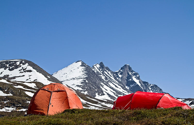
Wild camping is also possible thanks to Norway’s right to roam, but it comes with responsibilities. You may pitch a tent in uncultivated land as long as you keep at least 150 metres from inhabited houses or cabins, respect local signs and leave no trace.
In the mountains, camping is part of the culture, but popular areas are under increasing pressure. Camp carefully, avoid fragile vegetation, and take all rubbish with you.
Getting To Jotunheimen
Jotunheimen sits roughly midway between Oslo, Bergen and Trondheim. In theory, that makes it easy to place on a Norway itinerary. In practice, the mountains make travel slower than the map suggests.
Public transport is possible, especially in summer, with bus connections to gateway areas such as Lom, Gjendesheim, Tyin and Årdal. However, services are seasonal and timetables need careful checking.
For most visitors, a car offers the greatest flexibility. This is especially true if you want to combine Jotunheimen with the Sognefjord, Valdres, Geiranger, or several different trailheads.
That said, driving in the mountains requires planning too. Distances are longer than they look, fuel stations can be far apart, and some roads are seasonal.
Lom: A Good Gateway
Lom is one of the most practical bases for exploring the northern and eastern side of Jotunheimen. The village sits on Route 15, which links the E6 at Otta with the mountains and fjord region to the west.
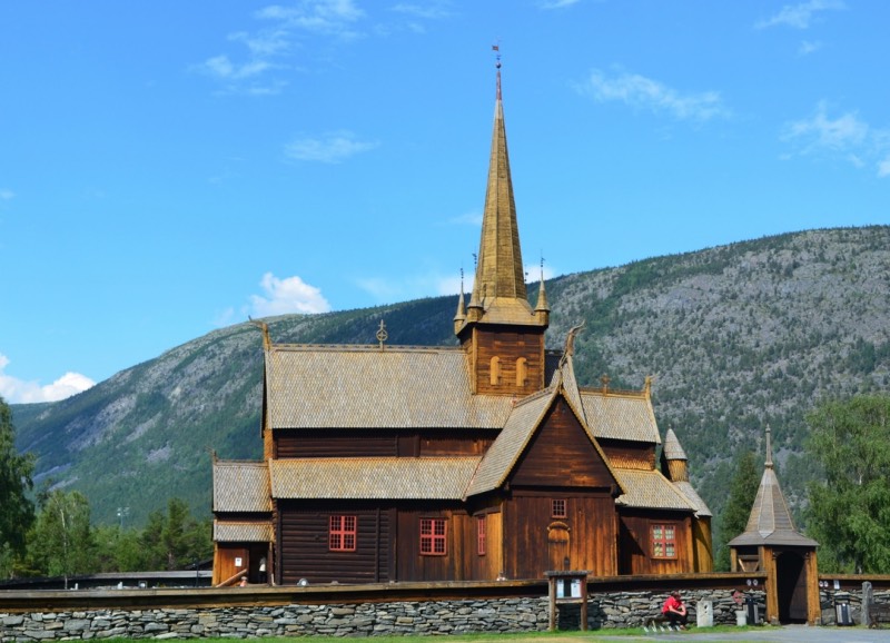
The town is best known for Lom Stave Church, one of Norway’s largest and most beautiful stave churches. There is also a national park visitor centre, accommodation, shops, cafés and bakeries, making it a useful stop even if you are not staying overnight.
From Lom, roads lead toward Juvasshytta, Spiterstulen and the Sognefjellet mountain road, putting some of Jotunheimen’s biggest experiences within reach.
Sognefjellet Mountain Road
If you are visiting Jotunheimen by car, try to include the Sognefjellet National Scenic Route. This road links Lom with the inner Sognefjord and is one of Norway’s great mountain drives.
The route climbs across a high mountain pass between Jotunheimen and Breheimen, passing lakes, snowfields, lodges and viewpoints.
Soon after the spring opening, the roadside snow walls can be enormous. Even in summer, patches of snow often remain on the surrounding mountains.
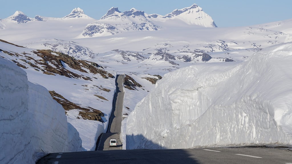
Sognefjellet is closed during winter and can close temporarily after reopening because of bad weather or night-time restrictions. Always check road conditions before setting out, especially in spring and autumn.
Practical Tips For Visiting Jotunheimen
Jotunheimen rewards preparation. Book accommodation early for July and August, especially around Gjende and the Galdhøpiggen trailheads.
Reserve Gjende boat tickets if hiking Besseggen. Check weather forecasts, but do not rely on them blindly: mountain weather changes quickly.
Dogs are welcome in many areas, but leash rules apply for much of the season, and extra care is needed around grazing animals, ground-nesting birds and reindeer. Drones are prohibited in the national park and protected landscape.
Fishing is possible in many lakes and rivers, but licences are required. Hunting is also regulated. If in doubt, ask locally at tourist information offices, lodges or DNT cabins.
Above all, do not treat Jotunheimen as a checklist. Galdhøpiggen and Besseggen are famous for good reason, but the quieter valleys, smaller peaks, lakeside cabins and scenic roads are just as much part of the experience.
This is mountain Norway at its most dramatic: accessible enough to visit, wild enough to respect, and memorable enough to stay with you long after you leave.