Varanger is one of Norway's most isolated places. Here's a visual guide of what to expect on a Varanger road trip.
Norway is known for its magnificent fjords and imposing mountains, but take a journey to the extreme north-east and things take on a very different picture.
Instead of fjords you’ll see birch woods and marshland. Instead of dramatic mountains there are rugged cliffs and open ocean. This is Varanger, the easternmost point in Norway.
Table of Contents
Where is Varanger?
Varanger is a peninsula in Troms og Finnmark, the vast county in the far north-east of Norway. The geography up here is hard to comprehend.
Firstly, the peninsula itself is vast, at 2,069 square kilometres (799 square miles). But perhaps even more striking, the small town Vardø is farther east than Saint Petersburg, Kiev, and Istanbul.
The municipalities of Vadsø, Båtsfjord, Berlevåg and Vardø make up the peninsula, together with bits of Tana and Nesseby. Altogether, just 11,000 people live in Varanger.

There are small airports in both Vardø and Vadsø from where you can hire a car and start your trip, but both offer only Widerøe regional connections to Tromsø and Kirkenes.
Alternatively, you can fly directly from Oslo to Kirkenes, but you'll need to add on approximately 78 miles to reach Varangerbotn and the beginning of the Varanger road trip.
The Varanger national scenic route
The 18 National Scenic Routes provide a starting point for trip planning, but not all are well-known or easy to access. Yet one of the most awkward to access for international visitors is also one of the most rewarding.
“It is difficult to explain other than by saying that this is a place where you feel as if time stands a bit still,” is how the Norwegian Public Road Administration describes the route from Varangerbotn to Hamningberg.
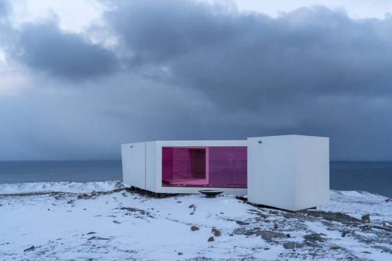
Varanger isn't a place to rush through. It’s ideal for wild camping, hiking and birdwatching. The best birding stops are the islands of Ekkerøya and Hornøya, and the Komagdalen bird trail in Varangerhalvøya National Park.
Highlights along the 160km route include the Sami cultural site Mortensnes, the Vardø witch memorial, and the abandoned fishing village Hamningberg. More on each of these later!
Varangerhalvøya National Park
The scenic route skirts the vast Varangerhalvøya National Park, which covers much of the plateau at the centre of the peninsula.

A hike in the Nattfjelldalen valley is the best way to enjoy some of the park. A 9km walk ends at a spectacular waterfall at the inner end of the valley. On a clear day, the highest parts of Nattfjelldalen offer views all the way to Russia's Rybachy peninsula.
Nesseby Church
The landmark Nesseby church is just a short walk down to the fjord from Nesseby village.
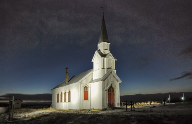
Unlike much of Finnmark, the charming white church was left interacted after World War II. Built in 1858, the church has a baroque altarpiece dating from around 1720.
Sami history of Varanger
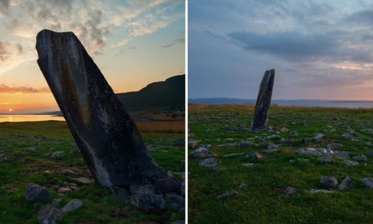
When driving through this remote corner of Scandinavia, it can be hard to believe that anyone lives here at all. Yet Mortensnes is one of the most distinct cultural sites in all of Scandinavia.
It’s home to Sami sacrificial sites and graves that cover more than 10,000 years of continuous settlement. Upgraded cultural trails and improved information facilities are to be opened in 2021 as part of the National Scenic Routes project.
The site is maintained by the Varanger Sami museum, which has a main site 20km away in Varangerbotn. The museum is a must-see to fill in the details of the coastal history of the Sami people stretching back thousands of years. Exhibitions cover religion, fishing and hunting, and some of the Stone Age findings from the region.
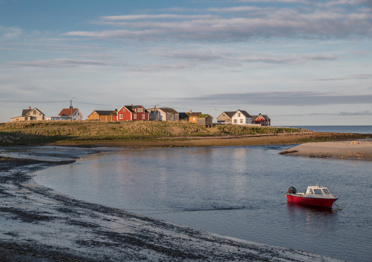
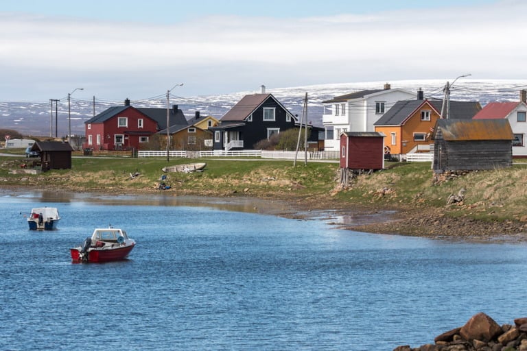
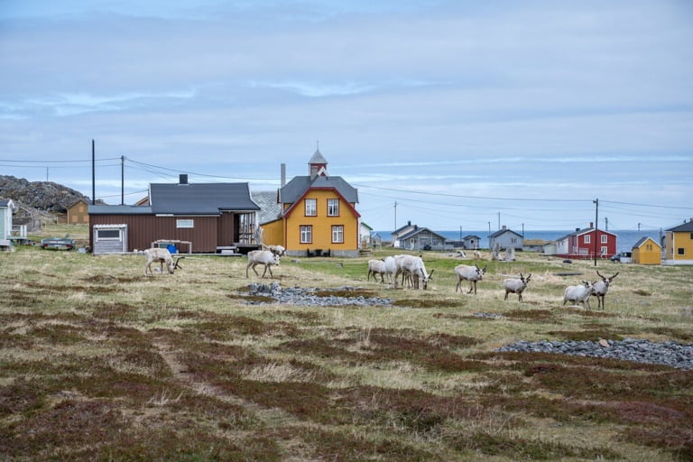
Vadsø
Only 5,000 people live in Vadsø but it will feel like a metropolis as you arrive from the scenic route. It's the ideal place to stock up on provisions for the rest of your trip.
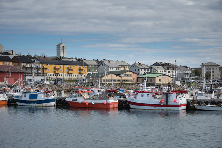
While you're in town, take a walk along Kjærlighetsstien (Lovers’ Trail). From here you'll get a feel for the force of the ocean in this part of the world.
Vardø
Norway's easternmost town, Vardø, is an island community with a dark past. Vardø today relies on a declining fishing industry and limited tourism, but it's also the strategically important site of the GLOBUS radar system.
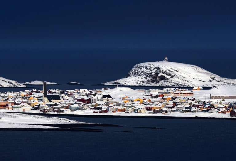
Much of the town was rebuilt after the destruction of World War II, aside from the older houses in Østervågen.
The Vardø witch memorial
400 years ago, a sudden, violent winter storm sank many fishing boats and drowned 40 men from the remote island community of Vardø.
A group of local women were found guilty of witchcraft following confessions given under torture and burned to death. It was the first of three major witch trials in the 17th-century that resulted in the execution of 91 people, mostly women.
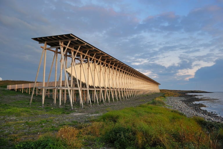
Take a moment to remember the victims and the gruesome events at the Steilneset Memorial, a short walk from the center of Vardø. Spending time at the striking memorial and browsing the adjacent exhibition building is not an enjoyable experience, but it is an important one.
Drakkar
On the northern part of the island, don't miss the fascinating wooden sculpture Drakkar-Laviathan.

Built in 2016, the part-Viking ship, part-whale, part-dinosaur wooden creation stands alone on the otherwise deserted coastline. It tells a story about the sea, migration and myths.
Mount Domen
Just outside Vardø, Domen is known from Norwegian folklore as where witches met with Satan. Today, it's home to a shelter for hikers and birdwatchers.
There is a great view of the fiord and the open sea. Several hundred thousand Arctic seabirds call this area their home.
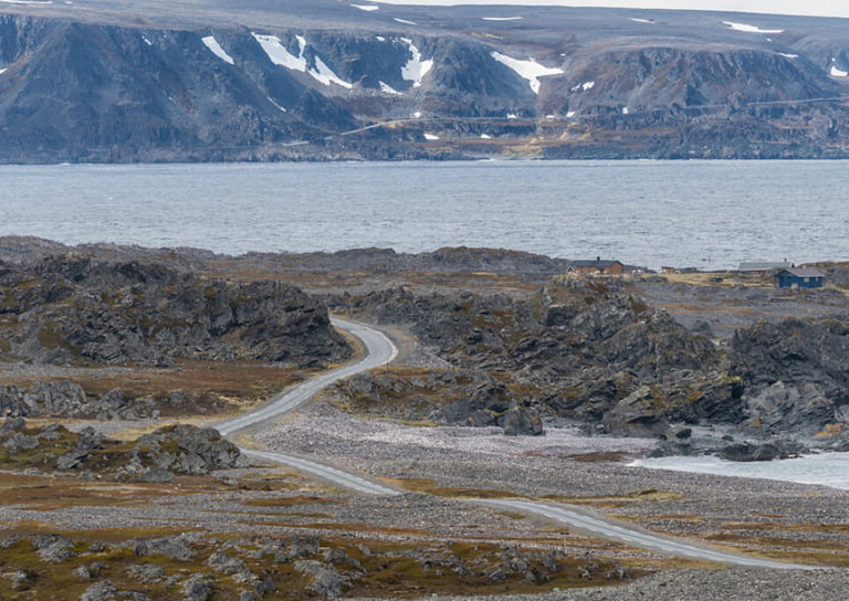
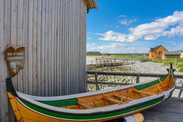
Hamningberg
Many of the houses in the abandoned fishing village Hamningberg were some of the few to escape the fiery destruction caused by retreating Nazi forces at the end of the Second World War.
Some 19th-century wooden buildings also contribute to the reminder of a lifestyle long gone.
It marks the literal end of the road in this part of Norway. Driving the last few miles towards Hamningberg, it really does feel as if you’re approaching the end of the earth. The sign terming it the “end of Europe” certainly contributes to that!
Once you're done in Hamningberg you'll need to turn around and retrace your steps, so plan this into your itinerary. Also, bear in mind this stretch of the road is closed during the winter, typically from November to early May.
Away from the scenic route: Berlevåg & Båtsfjord
The geography of the peninsula means that reaching the other main coastal settlements, Berlevåg and Båtsfjord, by car requires a long loop of the peninsula that can take four hours or more. That's one reason why air travel and boat connections are so popular in this part of Norway.
You can read this article on Berlevåg to find out more and see photos from a different part of Varanger.

If you’re interested in reading an historical fiction novel that takes places in this area and is based on the storm and witch trials, I highly recommend The Mercies by Kiran Millwood Hargrave. I really enjoyed the story of women’s resilience in the face of adversity and the setting was so intriguing.
I agree 100%! It’s a great book, and it’s actually how I found out about the Vardø witch trials before I wrote about them on here 🙂