

Vast, windswept and remarkably empty, Hardangervidda is one of Norway’s great wilderness landscapes and home to Europe’s largest wild reindeer population.
What sums up Norwegian nature to you? For many international visitors, the answer might be fjords, waterfalls or the northern lights.
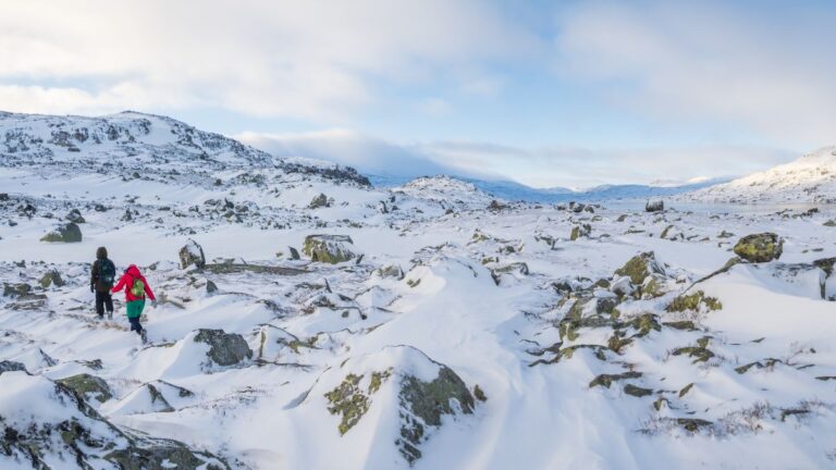
But there is another landscape that says just as much about Norway: the enormous mountain plateau of Hardangervidda.
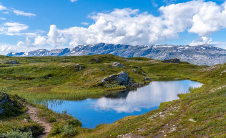
There are no dramatic fjord walls here. Instead, the appeal lies in scale. Treeless uplands stretch towards the horizon, broken by lakes, rivers, wetlands, rounded mountains and patches of snow that can linger well into summer. It's one of the great wilderness areas of Southern Norway.
Table of Contents
Welcome to Hardangervidda
Hardangervidda is generally described as the largest high mountain plateau in Northern Europe. The wider plateau covers around 8,000 square kilometres, extending across parts of Vestland, Buskerud and Telemark.
Much of the landscape lies around 1,100 metres above sea level, although the western side becomes considerably more mountainous.
The highest point within Hardangervidda National Park is Sandfloegga, at 1,721 metres above sea level. There is a noticeable difference between the two sides of the plateau.
In the east, Hardangervidda is characterised by broad, open expanses, large lakes and relatively gentle terrain.
Travel west and the landscape becomes wetter and more rugged as the plateau drops towards the fjords of Western Norway. That contrast is part of what makes Hardangervidda so interesting.
Hardangervidda National Park
Hardangervidda National Park was established in 1981 to protect the heart of this enormous mountain landscape. At 3,422 square kilometres, it is the largest national park in mainland Norway.
The park stretches across six municipalities: Eidfjord and Ullensvang in Vestland, Hol and Nore og Uvdal in Buskerud, and Tinn and Vinje in Telemark.
Around half of the land within the national park is privately owned, which makes Hardangervidda somewhat unusual among Norway's major protected areas.
The national park also forms just one part of the wider protected landscape. Immediately to the north lies the Skaupsjøen/Hardangerjøkulen protected landscape area, while the Møsvatn/Austfjell protected landscape lies to the east.
A truly enormous landscape
It's difficult to appreciate the scale of Hardangervidda until you actually travel through it. There are no towns in the middle of the national park and no public roads crossing its remote interior.
Norwegian National Road 7 crosses the northern part of the wider Hardangervidda plateau between Haugastøl and Eidfjord, while the Bergen Line railway passes through the high mountains farther north.
Away from those transport corridors, the landscape quickly becomes remarkably empty. In fact, Hardangervidda National Park contains the largest roadless area in Southern Norway.
For hikers, that means it is possible to walk for days through landscapes with very little visible sign of modern civilisation.
Hardangerjøkulen glacier
One of the most striking features of the wider Hardangervidda landscape is Hardangerjøkulen. Covering about 64 square kilometres, it is currently Norway's sixth-largest glacier.
The ice cap sits just north of the national park and is particularly prominent from the area around Finse and the Bergen Line.
Like almost all Norwegian glaciers, Hardangerjøkulen has shrunk considerably over time. Several outlet glaciers descend from the main ice cap, including Rembesdalskåka on its western side.
For visitors, one of the easiest places to appreciate the glacier is Finse. Guided glacier trips are available during the summer season, while several hiking routes offer views of the ice.
There is even a surprising piece of movie history here. Scenes representing the frozen planet Hoth in The Empire Strikes Back were filmed around Finse and Hardangerjøkulen in 1979.
People have lived here for thousands of years
Hardangervidda may feel untouched, but people have been using this landscape for thousands of years. The first hunters appear to have followed reindeer onto the plateau after the retreat of the ice following the last Ice Age.
Hundreds of Stone Age sites have been discovered across Hardangervidda, many positioned close to historic reindeer migration routes.
Some of the oldest evidence of human activity dates back more than 8,000 years. Reindeer were vital to these early communities, providing meat, hides, antlers and bones.
The relationship continued through later periods. Archaeologists have discovered hunting pits, stone structures and other evidence of organised reindeer hunting throughout the plateau.
When forests grew on Hardangervidda
Today's Hardangervidda is largely treeless, but that wasn't always the case. During warmer periods after the last Ice Age, woodland extended much higher into the mountains than it does today.
Evidence of ancient pine trees has been found well above the modern tree line. It's a fascinating reminder that mountain landscapes are not fixed.
Climate changes over thousands of years have repeatedly altered the vegetation of Hardangervidda, just as modern climate change is affecting its glaciers and ecosystems today.
Ancient routes across Norway
Before modern roads and railways, crossing Norway from east to west meant travelling through landscapes such as this.
Several ancient trails crossed Hardangervidda, linking communities around the Hardangerfjord with the valleys of Eastern Norway.
One of the best known is Nordmannsslepa, a historic network of routes connecting Eidfjord with Numedal and other areas to the east.
People travelled these routes with livestock and goods for centuries. Remains of old tracks, hunting sites, mountain farms and shelters can still be found across the plateau.
For today's hikers, this adds another dimension to the landscape. You may feel a long way from civilisation, but people have been moving through these mountains for an extraordinarily long time.
Wild reindeer on Hardangervidda
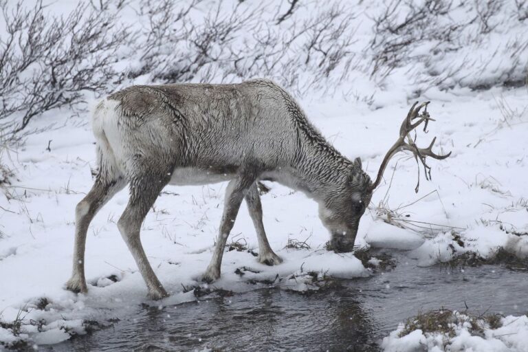
If one animal symbolises Hardangervidda, it is the wild reindeer. The plateau contains Europe's largest wild reindeer population and one of the most important remaining wild reindeer habitats anywhere in Europe.
These aren't the semi-domesticated reindeer associated with reindeer husbandry farther north in Norway. Hardangervidda's animals are genuinely wild.
The herds travel over enormous areas in search of suitable grazing grounds and calving areas, moving with the seasons and weather.
Why Norway's wild reindeer are under pressure
Despite the enormous size of Hardangervidda, wild reindeer need even more than simply open space.
Roads, railway lines, cabins, hydropower infrastructure and increasing recreational activity can all make it harder for animals to move freely between important grazing areas.
Reindeer are particularly sensitive to disturbance. A hiking trail that appears almost insignificant on a map can influence where a herd is willing to travel if enough people use it.
Norwegian authorities are therefore working on measures to improve conditions for the country's wild reindeer populations, including reducing disturbance in important habitats.
For visitors, the principle is straightforward. If you are fortunate enough to encounter wild reindeer, admire them from a considerable distance rather than attempting to approach them. The welfare of the animals comes first.
Don't expect to see reindeer
That said, don't plan a trip to Hardangervidda assuming you'll see a herd. You probably won't. The plateau is enormous, the reindeer are constantly moving and they deliberately avoid areas with lots of human activity.
That means sightings from National Road 7 or close to popular hiking areas are far from guaranteed.
For most visitors, learning about the animals at one of the visitor centres is a much more realistic way to understand their importance. Seeing wild reindeer themselves should be considered a bonus.
Other wildlife on Hardangervidda
Reindeer may dominate the story, but they aren't the only animals living here. Hardangervidda marks the southern limit of the range of several Arctic species.
Mountain foxes, also known as Arctic foxes, are associated with the wider Norwegian mountain ecosystem, while small mammals such as lemmings play an important role in the food chain.
Birdlife includes golden eagles, rough-legged buzzards and several species adapted to the high mountains. Ptarmigan are among the characteristic birds of the plateau.
The lakes and rivers are another important part of the ecosystem. Hardangervidda is well known for its mountain trout, making fishing a longstanding part of both traditional life and modern outdoor recreation. Remember that fishing rights and permits vary according to location.
Hiking on Hardangervidda
For many Norwegians, Hardangervidda is synonymous with hiking. The plateau contains an extensive network of marked trails and mountain cabins, making everything from day hikes to week-long expeditions possible.
The Norwegian Trekking Association, DNT, operates and maintains many of the routes and cabins. Some cabins are staffed during the main season, while others operate on a self-service or unstaffed basis.
This makes cabin-to-cabin hiking possible without carrying camping equipment and food for an entire journey.
Popular gateways include Finse and Haugastøl in the north, Haukeliseter in the south and several locations around Møsvatn and the eastern edge of the plateau.
Crossing Hardangervidda on foot
For experienced hikers, crossing the plateau is one of Norway's classic long-distance mountain journeys. One possibility is hiking south from Finse towards Haukeliseter, staying in DNT cabins along the way.
Another is to explore the central plateau using cabins such as Krækkja, Sandhaug, Litlos and Hellevassbu.
Distances between cabins can be substantial. Once you move into the interior, there are no shops, roads or easy escape routes. A change in weather can turn a straightforward day's walk into something considerably more challenging.
That's exactly what attracts many people to Hardangervidda, but it means preparation matters.
Summer comes late to the plateau
If you're unfamiliar with Norwegian mountain conditions, don't assume that June means summer. Snow can remain on Hardangervidda well into the season.
Some DNT routes depend on temporary summer bridges across rivers. These are generally installed around the beginning of the main hiking season and removed again in the autumn.
Conditions vary from year to year depending on snowmelt, rainfall and river levels.
Before setting off on a longer hike, always check current trail conditions, cabin opening dates and the status of any summer bridges.
Even in July and August, mountain weather can change remarkably quickly. Good clothing, proper footwear, a map and sufficient food should be considered essentials rather than optional extras.
Hardangervidda in winter
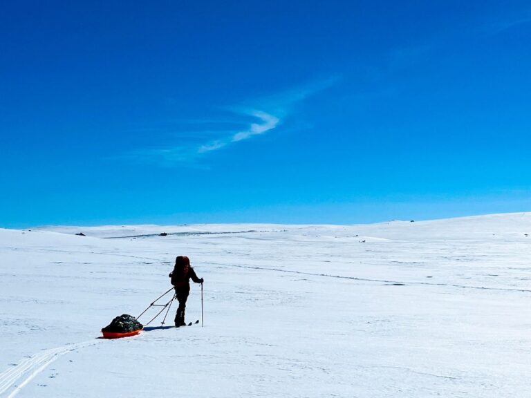
When winter arrives, Hardangervidda becomes a completely different landscape. Snow covers the lakes and trails, and skis replace hiking boots.
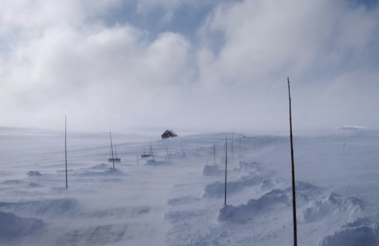
Cross-country skiing from cabin to cabin is a longstanding Norwegian tradition, particularly during late winter and around Easter.
However, winter travel on Hardangervidda requires considerably more knowledge and equipment than summer hiking. Temperatures can be severe, visibility can disappear quickly and distances between shelters are significant.
Marked winter routes are established during parts of the season, but anyone planning an independent journey should have appropriate winter mountain experience.
Finse: Hardangervidda by train
One of the most fascinating gateways to the mountains is Finse. At 1,222 metres above sea level, this tiny settlement on the Bergen Line has no public road connection. You arrive by train.
That alone gives Finse a wonderfully remote feeling. From the station, hikers can head towards Hardangerjøkulen, south onto Hardangervidda or north into Skarvheimen.
DNT's Finsehytta is just a short walk from the railway station and makes the settlement one of the easiest places in Norway to experience genuine high mountain scenery without a car.
The Bergen Line journey itself is also a good introduction to the landscape. Between Geilo and Myrdal, the railway climbs high onto the mountain plateau and passes through a bleak landscape of lakes, snowfields and exposed rock. Even in summer, snow is often visible around Finse.
Driving across Hardangervidda
If hiking isn't for you, there's a much easier way to experience the landscape. Norwegian Scenic Route Hardangervidda follows National Road 7 for 67 kilometres between Haugastøl and Eidfjord. The journey is one of Norway's great road trips.
From the east, the road climbs onto the broad mountain plateau before descending dramatically through Måbødalen towards the Hardangerfjord.
Along the way, the landscape changes from open high mountain terrain to steep-sided western valleys. The road reaches approximately 1,250 metres above sea level at its highest point.
Vøringsfossen
The biggest attraction on the scenic route comes close to the western edge of the plateau. Vøringsfossen is one of Norway's most famous waterfalls.
Here, water plunges into the deep Måbødalen gorge as the high plateau suddenly gives way to the dramatic landscape of Fjord Norway.
Modern viewing platforms and a spectacular pedestrian bridge provide several perspectives on the waterfall and canyon. From here, the road continues down through Måbødalen towards Eidfjord and the Hardangerfjord.

Few journeys demonstrate the contrast between Norway's mountain plateau and fjord landscape quite so clearly.
Driving Hardangervidda in winter
National Road 7 remains an important road between east and west, but winter travel is another matter entirely. Conditions on the exposed plateau can change rapidly.
During storms, the road may temporarily close or operate using convoy driving, with groups of vehicles following a snowplough across the mountain. Temporary closures can also occur to protect grazing wild reindeer.
Anyone driving across Hardangervidda in winter should check current road conditions immediately before travelling and be prepared for delays.
Hardangervidda National Park Centre
There are two main visitor centres for people wanting to learn more about the national park.
Hardangervidda National Park Centre is located at Skinnarbu near Møsvatn in Telemark. Its exhibitions focus particularly on the wild reindeer and the remarkable relationship between the animals, people and the mountain environment.
The Norwegian Wild Reindeer Centre South is also based at Skinnarbu. This makes it an excellent place to understand Hardangervidda before heading into the landscape itself.
Norwegian Nature Centre in Eidfjord
On the western side of Hardangervidda, Norwegian Nature Centre Hardanger is located in Øvre Eidfjord. The centre focuses on the nature, geology, climate and environment of the Hardanger region and Hardangervidda.
Its location makes it a convenient stop for anyone travelling along National Road 7 between the plateau and the Hardangerfjord.
The extraordinary distance between these two visitor centres tells you something about Hardangervidda itself. They sit on opposite sides of the same landscape, yet travelling between them by road involves a substantial journey.
Is Hardangervidda worth visiting?
Hardangervidda isn't Norway's most immediately dramatic landscape. There are no sheer walls like those of the Geirangerfjord, and its rounded mountains can't compete with the jagged peaks of Lofoten for instant visual impact.
Hardangervidda is about space. It's about standing in a landscape where the horizon seems impossibly far away, watching clouds race across an enormous sky and realising there may be very few people for kilometres in every direction.
For a short taste, take the train to Finse or drive National Road 7. For something more memorable, lace up your hiking boots and spend a few days moving between mountain cabins. That's when the true scale of Hardangervidda begins to reveal itself.


When I did a tour in the Hardangervidda we scrambled up Harteigen which is a volcanic plug that can be seen from miles away. It is an amazing area and so vast. It is difficult to envisaged its vastness until you are there.
I’ve been on Hardangervidda a few times. One time when I went with some Norwegian friends we caught a boat at a place(I forget the name) where we were taken into Hardangervidda and stayed overnight at a Tourist hytte, and then walked across the Vidda for two days, I think (maybe three, it was a few years ago) until we came to Skinnabu, where we had left three cars, and drove home (Flekkeroy and Kristiansand). I really enjoyed the times I spent on Hardangervidda.
This is where my great great grandparents came from. I have always wanted to visit. However, I am disabled…hiking is not impossible…but not easy for me. I have Cerebral Palsy. Are there places in Hardangervidda that I could access? Takk.
The terrain isn’t exactly easy but there are options. I would suggest taking a boat over the lake Mosvatn, staying in the hut Mogen and taking trips from there: https://en.mapy.cz/s/begapalube Or more demanding would be hiking up this beautiful valley to Hadlaskard (with overnight in the Hedlo hut in the middle): https://en.mapy.cz/s/kekudogeke
I was born in Bergen, raised in US. Love learning about my home. Hope to go there soon.
You could get off the route 7 at Dyranut and drive to tinnhylen. From there it is 13km in flat terrain on good paths to Sandhaug DnT hut. Beautiful place dead center in i Hardangervidda.
Or you can just stay at Dyranut or tinnhylen (trondsbu hut) and do short walks in the area.
If short walks are your thing i would seriously consider the train from Bergen or Oslo to Finse and stay at the Finse hut 10 minutes from the train station. Beautiful area and often the starting point for hikers crossing the plateau. Lots of possibilities for short or long walks. Close to the Hardangerjøkulen glacier.